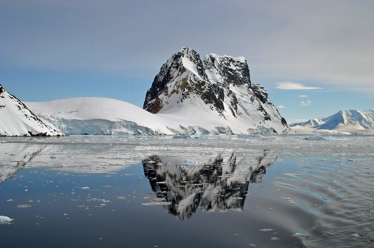
There is a stretch of water on the Antarctic Peninsula that silences a ship. I have seen it happen again and again: passengers drift up to the bow chattering, and then, as the vessel noses into the lemaire channel, the talk simply stops. Sheer cliffs rise a thousand metres on either side, close enough it seems you could touch them, the water lies flat as black glass, and icebergs float in the stillness like sculptures in a gallery. For my money, it is the single most beautiful place a ship can take you in all of Antarctica.
The Lemaire is not a destination you land on but a passage you sail through, and that is part of its magic — eleven kilometres of pure, concentrated wonder, often experienced in reverent silence from the open decks. In this guide I will tell you exactly where it is, why it earned its famous nickname, what it is like to glide through it, and the constellation of landing sites at either end that make this corner of the Peninsula one of the great highlights of any voyage south.
The Lemaire Channel: Antarctica’s Most Beautiful Passage
The lemaire channel is a narrow strait that threads between the mountainous mainland of the Antarctic Peninsula and rugged Booth Island, on the western side of the peninsula well to the south of the usual northern landing sites. It runs about eleven kilometres long and narrows to roughly six hundred metres at its tightest — a startling slot for a hundred-metre expedition ship to slip through, with cliffs and glaciers towering on both flanks.
What makes it extraordinary is not just the scale of the walls but the calm. Sheltered from the open ocean, the channel’s protected waters are often utterly still, mirroring the peaks and the floating ice in a way the storm-wracked southern seas almost never allow. To sail it on a windless morning is to move through a doubled world of rock, ice and reflection. It is the jewel of the wider Antarctica regions and landing sites, and a centrepiece of my Antarctic Peninsula guide.
Why It’s Called “Kodak Gap”
Long before smartphones, expedition staff gave the Lemaire Channel a nickname that has stuck: “Kodak Gap,” sometimes “Kodak Alley” or “Kodak Crack,” in wry tribute to the sheer number of photographs taken as ships passed through. The name is a gentle joke about how every camera on board comes out at once — and how no photograph ever quite does the place justice.
The nickname endures because the reality lives up to it. The combination of vertical cliffs, hanging glaciers, mirror water and drifting icebergs produces compositions so striking that even indifferent photographers come away with images they treasure. But the Lemaire is one of those places that rebukes the camera; the scale, the silence and the sense of being swallowed by the mountains simply cannot be captured. You have to be there, on the deck, in the cold, to understand.
What It’s Like to Sail Through
The approach builds the drama. From the north, the channel announces itself with a pair of dramatic peaks at its entrance, and then the walls close in and the ship seems to shrink. Crew often cut the engines to a crawl, and a hush falls over the decks; the only sounds are the crackle of brash ice against the hull, the distant boom of a calving glacier, and the occasional gasp as someone spots a whale or a seal on a passing floe.
It can take an hour or more to transit, and seasoned travellers spend every minute of it outside, however bitter the air, because moments like this are why they came. There is a particular quality of awe to the Lemaire that is different from the busy joy of a penguin landing — quieter, more solemn, almost spiritual. It is, for many, the emotional high point of the entire trip, and one of the most memorable of all the things to do in Antarctica.
The Discovery and the Name
The Lemaire Channel was first seen by a German expedition in 1873-74 but not actually sailed until December 1898, when the Belgica, ship of the Belgian Antarctic Expedition under Adrien de Gerlache, threaded through it. De Gerlache named the channel not after a fellow polar explorer but after Charles Lemaire, a Belgian who explored the Congo — a curious bit of naming that links this pristine Antarctic passage to the very different history of central Africa.
The Belgica expedition itself was a landmark: its crew, which included a young Roald Amundsen, became the first to overwinter in Antarctic waters when their ship was trapped in the ice. To sail the Lemaire today is to follow directly in their wake, through a passage essentially unchanged since those wooden-ship pioneers first braved it. That sense of historical continuity adds depth to the beauty, connecting the channel to the wider story told in my overview of Antarctica cruises.
Cape Renard and the Gateway Peaks
The northern entrance to the channel is guarded by one of the most photographed landmarks on the Peninsula: the dramatic twin spires of Cape Renard, often called Una’s Peaks (and, by expedition crews with a sense of humour, by a ruder nickname). These sharp, often cloud-wreathed towers of rock and ice frame the entrance like a gateway, and rounding them to enter the channel is a genuinely cinematic moment.
The peaks set the tone for everything that follows: vertical, severe, impossibly grand. In the right light they glow gold or pink, and in mist they loom and vanish like something from a legend. They are the threshold to the Lemaire, and the first hint that you are entering somewhere special. Few gateways anywhere in the world announce a place so emphatically.
The Icebergs and the “Back Door”
The Lemaire’s narrowness and beauty come with a catch: it can be completely blocked by ice. Especially early in the season, icebergs and pack ice drift into the channel and jam it shut, and no captain will risk wedging a ship into a closing slot. When this happens, the only option is to backtrack and sail the long way around the outside of Booth Island — the “back door” — to reach the sites at the southern end.
This means a Lemaire transit is never guaranteed, and travellers learn to hope for it rather than count on it. When the ice cooperates and the channel is open, it is cause for quiet celebration on board. When it does not, the detour around Booth Island has its own wild beauty, and there is always the chance of a successful passage on the return leg. The ice, as everywhere in Antarctica, has the final say.
The Wildlife of the Channel
Though the Lemaire is above all a scenic transit, it is far from lifeless. The sheltered, ice-strewn water is a favourite haunt of wildlife, and a slow passage often turns up some wonderful sightings. Keep your eyes on the floes and the water and you may spot:
- Crabeater seals — lounging on ice floes, often in groups, the most numerous large mammal in Antarctica.
- Leopard seals — sleek and solitary, sometimes hauled out on a passing berg.
- Humpback and minke whales — feeding in the channel and its approaches through the summer.
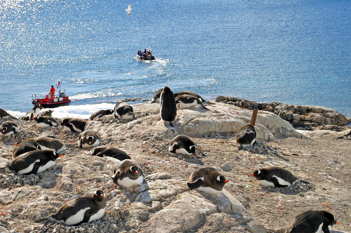
- Gentoo and Adélie penguins — porpoising through the water or gathered on nearby shores.
- Blue-eyed shags and petrels — wheeling along the cliffs and over the ice.
A whale surfacing in the mirror-still water beneath those vast cliffs is one of the defining images of an Antarctic voyage. To understand the animals you may meet, my guide to Antarctica wildlife is the perfect companion to a Lemaire transit.
Petermann Island at the Southern End
The Lemaire does not lead nowhere; it opens onto one of the loveliest clusters of landing sites on the whole Peninsula. Chief among them is Petermann Island, just beyond the channel’s southern mouth, home to the southernmost gentoo penguin colony in the world and a population of Adélie penguins too. A small refuge hut and a memorial cross add a human touch to a place of great natural beauty.
Landing at Petermann after sailing the Lemaire feels like a reward for the journey, and the island offers wonderful views back toward the channel and its guardian peaks. For many itineraries this marks the southernmost point of the entire voyage, the deepest the ship will penetrate into Antarctica before turning north again. It is a fitting climax to the Peninsula’s most beautiful stretch.
Pleneau Bay: The Iceberg Graveyard
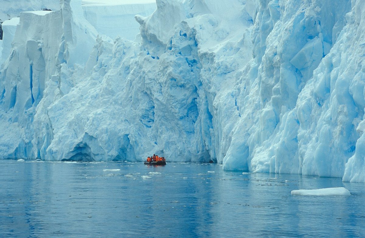
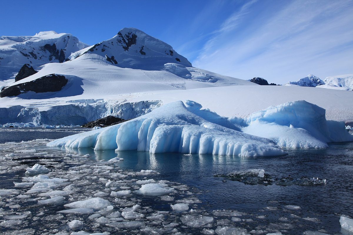
Near Petermann lies one of my favourite spots in all of Antarctica: Pleneau Bay, often called the “iceberg graveyard.” Here the shallow water and underwater shelf trap drifting icebergs, which run aground and linger, sculpted by wind and sea into fantastical shapes — arches, towers, caverns and improbable spires in every shade of white and blue. A Zodiac cruise among them is an unforgettable, slightly dreamlike experience.
The bergs of Pleneau are constantly changing as they melt and topple, so no two visits are ever the same, and the photographic possibilities are endless. Drifting silently among these grounded giants, with the engine cut and the only sound the fizz of ancient air escaping the ice, is the Peninsula at its most magical. It pairs perfectly with the grandeur of the Lemaire just to the north.
Booth Island and the Stations Beyond
Booth Island, which forms the western wall of the channel, is a rugged, Y-shaped island with its own gentoo, Adélie and chinstrap penguins and a place in history as a base for the French explorer Jean-Baptiste Charcot in the early twentieth century. Beyond it and Petermann, the route south leads toward Vernadsky and the old Wordie House, among the most characterful of all the research stations you can visit, where a Ukrainian base famously runs the southernmost bar in the world.
This whole southern sector of the Peninsula — Lemaire, Petermann, Pleneau, Booth, Vernadsky — forms a kind of grand finale to a classic voyage, the deepest and arguably most beautiful part of the journey. The Lemaire Channel is the gateway to it all, the dramatic doorway through which the finest scenery of the trip is reached.
Photographing the Lemaire Channel
If you care about photography, the Lemaire is the moment to be ready. Be on deck early as the ship approaches Cape Renard, with a wide lens to capture the gateway peaks and the sweep of the cliffs, and a longer lens for the wildlife and the detail of hanging glaciers. The still water makes for spectacular reflection shots, so look for symmetry, and shoot in the soft, low light of “morning” or “evening” — concepts that blur under the near-endless daylight of high summer.
Above all, remember to put the camera down. The Lemaire is one of those rare places that deserves to be experienced with your own eyes, not just through a viewfinder. Take your photographs, then lower the lens, feel the cold air, and simply watch the cliffs slide by. The memory will outlast any image. For the gear that survives these conditions, see my notes in what to pack for Antarctica.
When Conditions Are Best and Will My Cruise Sail It?
The Lemaire features on most classic Peninsula itineraries that venture far enough south, but whether a given ship actually transits it depends entirely on ice and weather. Later in the season — January through March — the channel is more often clear of blocking ice than in the early weeks of November and December, though there are no guarantees in either direction. Calm, clear days deliver the famous mirror conditions, but the channel is magnificent in any weather.
If sailing the Lemaire matters to you, choose an itinerary that ventures into the southern Peninsula around Petermann Island, and keep your expectations flexible. My guide to the best time to visit Antarctica and my overview of Antarctica cruise itineraries will help you pick a voyage that maximises your chances of this unforgettable passage.
The Lemaire and Antarctica’s Other Great Channels
The Lemaire is the most famous of the Peninsula’s channels, but it does not sail alone. Further north, the broad Gerlache Strait and the tighter Neumayer Channel offer their own glacier-draped grandeur, and many voyages thread several of these passages over the course of a trip. What sets the Lemaire apart is the combination of extreme narrowness, the height of its walls and the reliable stillness of its water — it is the most concentrated, most intense of them all.
Think of the channels as a crescendo. The Gerlache opens the symphony with sweeping mountain vistas; the Neumayer tightens the focus; and the Lemaire delivers the climax, the moment when the walls close in and the whole ship holds its breath. Sailing more than one in a single voyage is one of the quiet privileges of a southern Peninsula itinerary, and a reminder that here the journey between sites is every bit as spectacular as the sites themselves. The nearby beauty of Paradise Bay completes the picture.
Tips for Experiencing the Lemaire Channel
A few practical pointers will help you make the most of a Lemaire transit. First, listen for the announcement — the expedition team will usually broadcast when the ship is approaching, often early in the day, and you do not want to miss the entrance at Cape Renard. Dress warmly enough to stay outside for an hour or more, because the best of the channel is experienced on the open decks, not through a window, and the cold is worth enduring.
Second, find a spot away from the crowds if you can — the bow is popular, but the upper decks and the stern often offer quieter vantage points and different angles back toward the gateway peaks. Third, be patient and stay out for the whole passage; the most dramatic narrows often come partway through, and whales or seals can appear at any moment. And finally, accept that the channel may be closed by ice; if it is, the detour around Booth Island is no consolation prize but a wild and beautiful experience in its own right. The ice writes the script here, and that unpredictability is part of the romance.
Frequently Asked Questions
Where is the Lemaire Channel?
The Lemaire Channel is on the western side of the Antarctic Peninsula, running between the mountainous mainland of Graham Land and Booth Island, to the south of the main northern landing areas. It lies near Petermann Island and is usually reached on itineraries that venture into the southern Peninsula, making it one of the deeper-south highlights of a classic voyage.
Why is the Lemaire Channel called Kodak Gap?
It earned the nickname “Kodak Gap” (also “Kodak Alley”) because of the sheer number of photographs taken as ships pass through — every camera on board tends to come out at once. The name is a gentle joke about the channel’s astonishing beauty, with its towering cliffs, mirror-still water and floating icebergs producing endlessly photogenic scenes.
How long and how narrow is the Lemaire Channel?
The channel is about eleven kilometres long and narrows to roughly six hundred metres at its tightest point, with cliffs rising as high as a thousand metres on either side. That makes it a dramatically tight squeeze for a large expedition ship, and a big part of why sailing through it feels so awe-inspiring.
Will my cruise definitely sail through the Lemaire Channel?
Not necessarily. The channel can be blocked by icebergs and pack ice, especially early in the season, forcing ships to detour around the outside of Booth Island. Whether you transit it depends on ice and weather on the day. Choose an itinerary that reaches the southern Peninsula to maximise your chances, but treat a successful passage as a hoped-for highlight.
Can you land in the Lemaire Channel?
No — the Lemaire is a scenic transit, not a landing site. You experience it from the deck of the ship as it sails through. The landings come at either end, particularly Petermann Island, Pleneau Bay and Booth Island just beyond the southern mouth, which together with the channel form one of the most beautiful sectors of the entire Peninsula.
What wildlife can you see in the Lemaire Channel?
Despite being a transit, the channel is rich in wildlife. Crabeater and leopard seals haul out on the ice floes, humpback and minke whales feed in and around the channel, and gentoo and Adélie penguins porpoise through the water. Seabirds such as blue-eyed shags and petrels wheel along the cliffs. A whale in the mirror-still water is a classic Lemaire sight.
Who discovered the Lemaire Channel?
It was first seen by a German expedition in 1873-74 but first sailed in December 1898 by the Belgica, the ship of Adrien de Gerlache’s Belgian Antarctic Expedition. De Gerlache named it after Charles Lemaire, a Belgian explorer of the Congo. The Belgica expedition, which included a young Roald Amundsen, became the first to overwinter in Antarctic waters.
Is the Lemaire Channel worth it?
Absolutely. Many travellers rate sailing the Lemaire Channel as the single most beautiful and moving experience of their entire Antarctic voyage. The combination of towering cliffs, mirror-still water, drifting icebergs and profound silence is unlike anywhere else. If your itinerary offers the chance, be on deck for every minute of it.
Final Thoughts
The Lemaire Channel is the kind of place that rearranges your sense of scale and beauty. To stand on a cold deck as your ship slides between those vast cliffs, the water doubling the mountains and the ice, the whole world hushed — it is an experience that stays with you long after the penguins and the icebergs blur into a happy haze. It is, quite simply, one of the most beautiful eleven kilometres on the face of the Earth.
If you are lucky enough to sail it, do not spend the whole time behind a lens. Take your photographs, of course, but then put the camera down, feel the bite of the air, and let the cliffs and the silence work on you. The Lemaire does not need your camera; it needs your attention. Give it freely, and it will give you a memory to last a lifetime — the soul of Antarctica distilled into a single, perfect passage.
Related Reading
- Antarctica’s regions and landing sites
- The Antarctic Peninsula: complete guide
- Paradise Bay (Paradise Harbour)
- The South Shetland Islands
- Antarctic research stations you can visit
- The Weddell Sea
- Antarctica cruises
- Antarctica cruise itineraries
- Antarctica wildlife
- The best time to visit Antarctica
- Things to do in Antarctica
- What to pack for Antarctica